
Our friend Alan Howarth at Kinder Mountain Rescue has recently been doing some work on analysing the Kinder MRT callout data.
Where people walk on Kinder, what the most popular routes are and if possible, where people struggle with their navigation. Having looked around for data he hit on the Strava Global Heatmap. This is an anonymous collection of all Strava users route data, combined to show both the individual routes and where the most traffic is. A route which only one person has taken shows as a single red line. Where multiple people have used the same route it turns yellow and if there is a really high level of traffic it glows bright white.
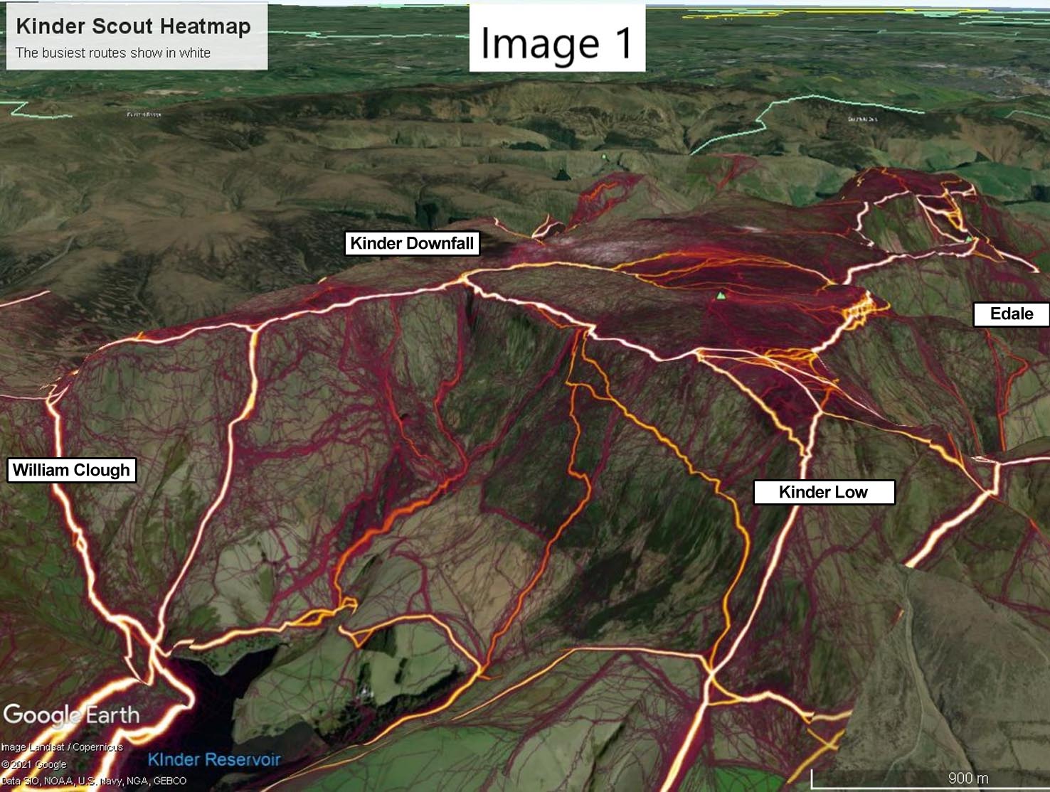
So, what does our area look like? [Image 1].The heatmap for Kinder shows the main routes around the edge path really clearly, with most people going along the reservoir, up either William Clough or Sandy Heys, on to the Downfall and back via Kinder Low. However it’s interesting to see all the minor routes that people have followed.
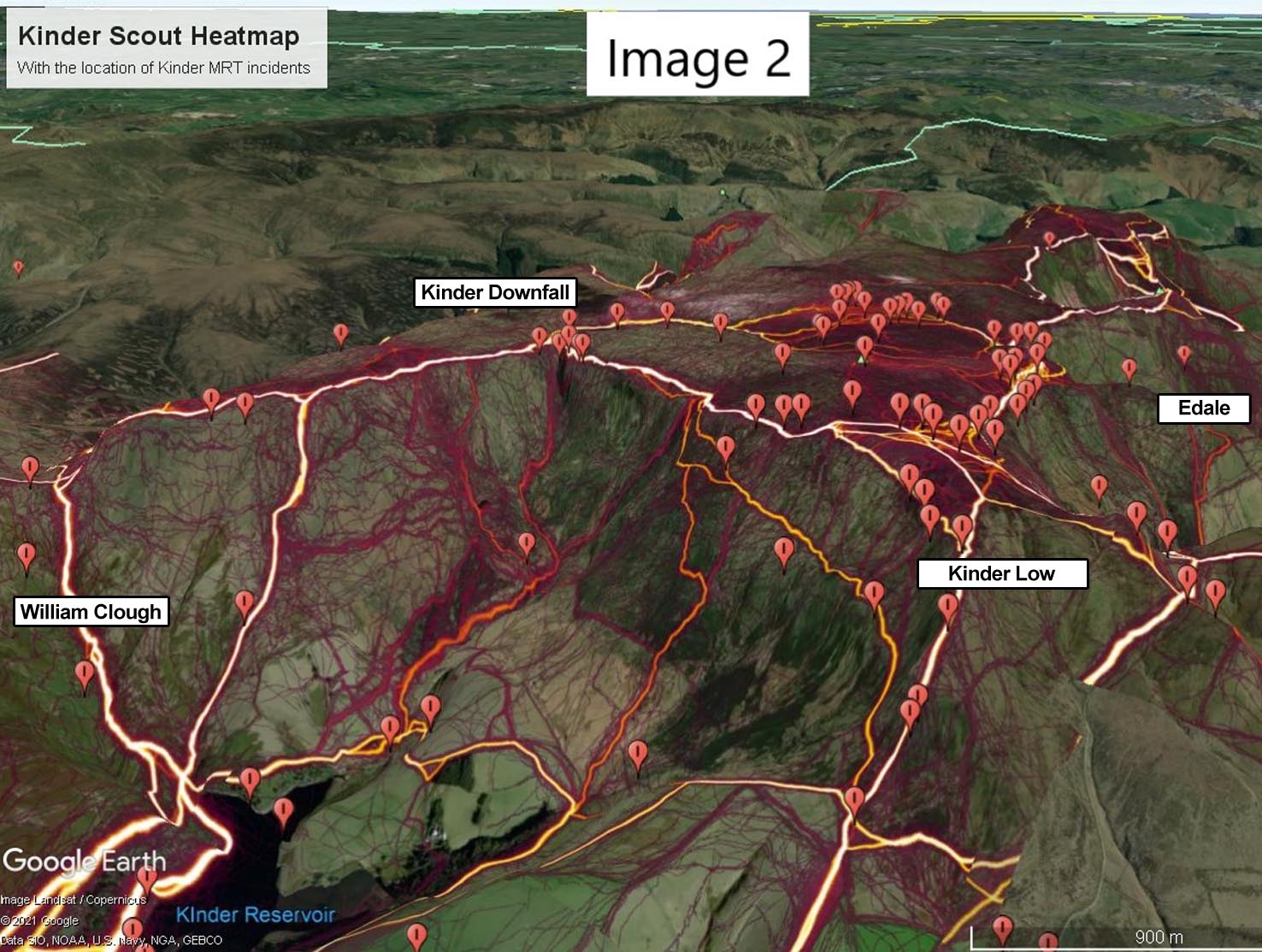
Where it starts to get interesting is the map on the locations of KMR incidents. These are a mix of lost people and injuries over the last four years. They are mainly in our patch (the west side of Kinder), but also cover jobs where we have worked with the other teams in the area (mainly Buxton, Glossop & Edale teams [Image 2].
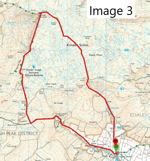
Looking at a couple of popular routes to find the ones where we have the most incidents and the clear winner was the Edale to the Downfall circuit. This route starts in the Edale valley, heads up Jacobs Ladder, follows the edge path to the downfall, then heads back to Edale using the Old Pennine way via Crowden Clough. On the OS map it looks like a really solid footpath making its way across the plateau from the Downfall to Crowden Clough [Image 3].
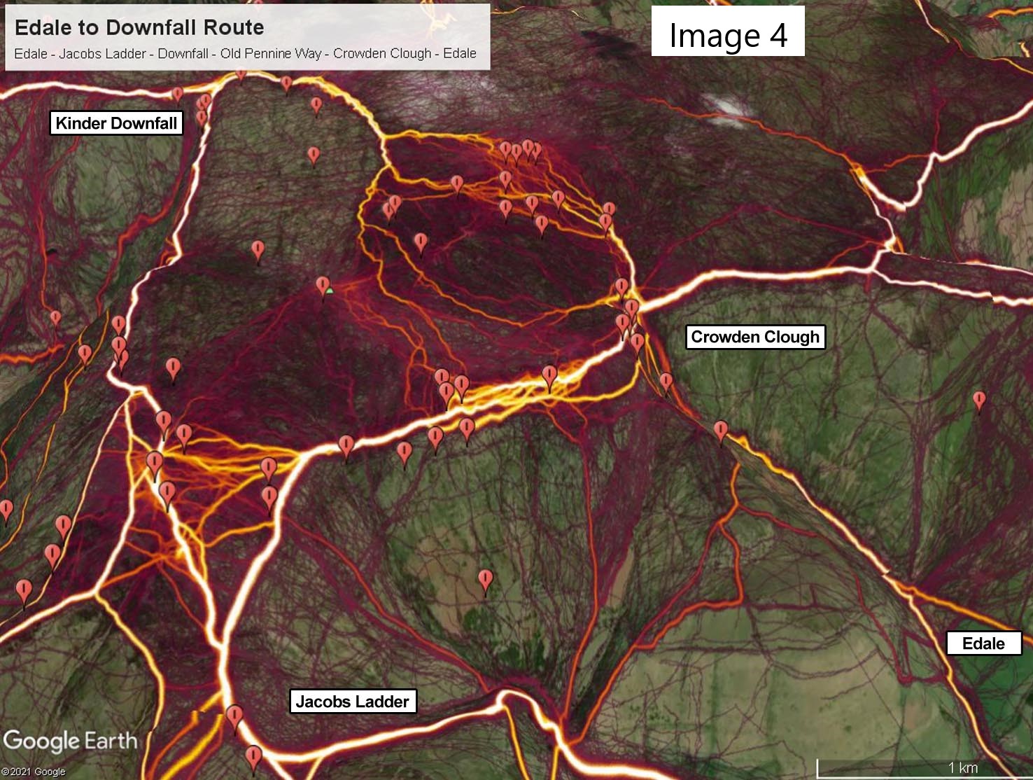
In reality we all know that there isn’t a path through the middle of the plateau. If you follow the Kinder River up to the point where it splits (after Kinder Gates), the path disappears and it’s just a horrible (if weirdly beautiful) boggy wilderness. The Strava data shows that really well with the tracks becoming much more scattered as the path disappears [Image 4].
On a clear day you can usually see where you need to end up and make your way over there. If you are unlucky, you may end up waist deep in mud, but that should be about as bad as it gets .
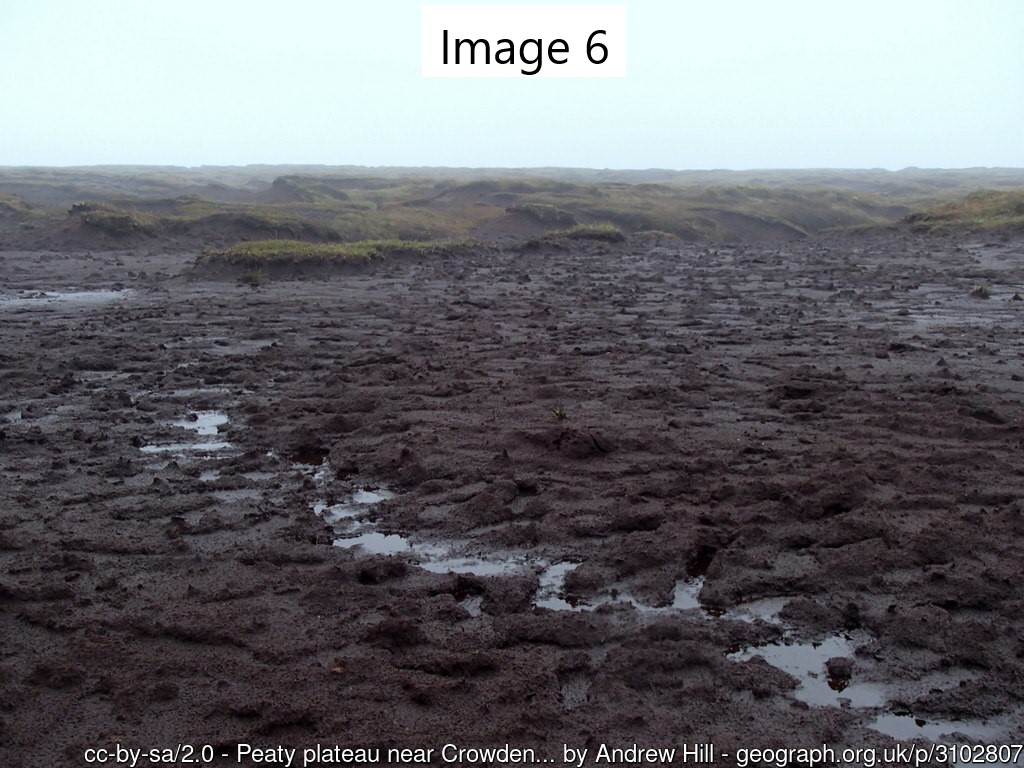
In the dark, low cloud or bad weather, it’s a different matter and if you don’t have good navigation skills, it can be very challenging. When people call us from here to say they are lost and can’t find their way out, one of two things happen. If they manage to keep a good phone signal (and it’s notoriously patchy up there) and we get a GPS position from their phone, it’s just a very uncomfortable 2-3 hour wait for us to get to them and navigate them back down. If we don’t have a position for them and are only working off a rough route description they gave to the 999 call handler, it becomes a major search. We have a pre-plan for this situation where the four teams who cover the area (Kinder, Buxton, Edale and Glossop) all search pre-defined areas of the plateau. This can take a long time, so what would have started out as a great day out on Kinder will now have turned in to a really cold, really bad night. No one starts out planning to have a bad day, but I suppose the message behind this is if you are thinking of taking one of these more challenging routes, just have a think if you have enough equipment to sit around in the cold for 4-5 hours if the worst were to happen. If you want any help with what to take, have a look at this website to help you get the most out of your day – www.adventuresmart.uk. As usual, if you’d like to support the work we do, as we are entirely funded through public donations, please use https://www.justgiving.com/kmrt